Citizen Science in South America
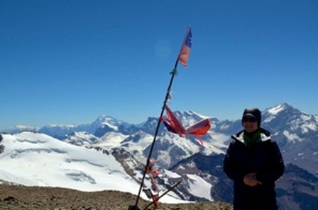
Kurt Sanderson on the summit of Cerro El Plomo. Photo Credit: Kurt Sanderson
I just got back late last night from Cerro Plomo. Given our team’s changing schedules and the Ruta Patrimonial de Río Olivares park and roads closure for our “Plan A Expedition” to Nevado del Plomo (6,070 meters) in the neighboring valley, I started out solo on Sunday, February 24, for a two-day attempt at Cerro Plomo (5,430 meters). On the approach to El Plomo, I met several climbers returning home, most only having ascended to Refugio Angostini at 4,600 meters due to dangerously high winds. As they descended and I ascended, I kept thinking of the mountain forecast that predicted light winds on what would be my summit day with hopes that the forecast would hold fast.
Once I got to base camp, I pitched my tent, took a long drink of glacier melt water, and collected my first glacier melt samples at 4,200 meters for researchers at theByrd Polar Research Center. I was pondering the following day’s solo summit bid, when two French climbers appeared over the scree hill that marks the western edge of base camp. We ended up talking with the last of a group of Chilean climbers that were headed down. It seems Chilean couple were the only ones to have gutted through the wind and summited against odds that day.
Once I got to base camp, I pitched my tent, took a long drink of glacier melt water, and collected my first glacier melt samples at 4,200 meters for researchers at theByrd Polar Research Center. I was pondering the following day’s solo summit bid, when two French climbers appeared over the scree hill that marks the western edge of base camp. We ended up talking with the last of a group of Chilean climbers that were headed down. It seems Chilean couple were the only ones to have gutted through the wind and summited against odds that day.
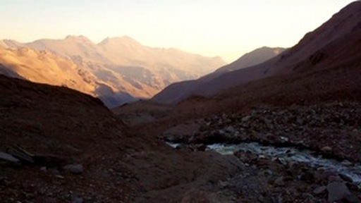
El Cepo Stream in the upper valley. Photo credit: Kurt Sanderson
I quickly teamed up with the French climbers, one of whom was a new member of DAV, the Chilean mountaineering club. We ended up lucking out with perfect mountaineering weather, sun and light winds, all the way to the top! Seems thatMountain Weather Forecast remained correct.
I collected snow and water samples for glaciologists at Byrd Polar Research Center (starting at about 5,200 meters at the top of the Iver Glacier, a glacier that feeds into Santiago’s main water supply). I also collected rock samples on a 1,000-meter elevation gradient for Adventurers and Scientists for Conservation and Biosphere 2(from the 5,400 meter summit down to 4,400 meters). For each data point, I recorded a GPS coordinate and a few photos of each site to show geography and close up of the sampling area.
I did not come across any T. vermicularis lichen along this route as I started the approach around 3,500 meters.
The data will help fill in the picture of how the glacier has shaped the valley and how the water changes as it travels from the top of the glacier through the wetland, including interactions with other streams that feed into the main El Cepo stream. Water samples are in the fridge and rock samples are in the freezer. I will ship water samples out to Byrd Polar Research Center for water isotope concentration, nutrient, and cations/anion analysis and rock samples to Biosphere 2 for analysis and inclusion in a global study on high montane microbes.
There are a few more data points that I will return to collect in the lower valley soon. Until then, check out more extensive description of the purpose of this glaciology research and alpine microbe research.