
My mind raced as I picked my way through a snowy rhododendron tunnel. It was late March, and I had just returned home to the Allegheny Mountains of West Virginia from a 16-day assignment to explore the northern reaches of Chilean Patagonia. I needed a peaceful place to reflect on the whirlwind trip.
For me, the welcoming wilds of Appalachia offer the perfect meditative setting.
To my right, tea-colored water tumbled over sandstone ledges and through chaotic catacombs of gnarled roots and mossy boulders. The thick forest dropped off into a steep canyon, the other side barely visible through the opaque, wintry air. I paused.
The noise of my mind suddenly disappeared, drowned out by the peacefully deafening sound of rushing water. My senses became intensely acute. With each breath, the rich, musty scent of rotting earth flooded my nostrils while the damp, icy air burned in my lungs.
I spun my head around. Blended shades of green, red, and white became razor sharp as every feature of the forest came into focus. I was struck with awe by the rugged beauty that surrounded me.
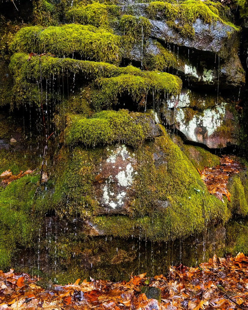
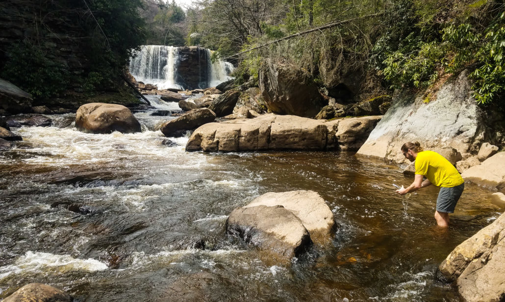
I continued down the near-vertical drop of Shay Run beyond the falls. A jumble of car-sized boulders hundreds of feet below marks its confluence with the legendary Blackwater River, which gets its name from the dark color imparted by tannins in decomposing red spruce and hemlock needles.
My mind came roaring back. I thought about my time in Chile, where I augmented my adventures by collecting freshwater samples for Adventure Scientists’ Global Microplastics Initiative.
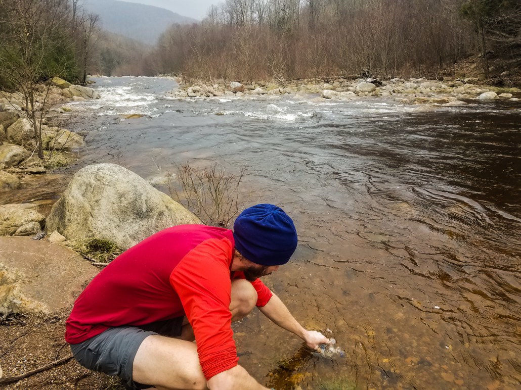
Something else struck me. Over the years, I had collected water samples while adventuring in Thailand, Costa Rica, and more recently Chile, but had neglected to sample the gorgeous waterways in my home state. After thinking about Shay Run and that vast network of rivers forming across West Virginia’s public lands, I felt an obligation to change that. I checked the project’s sample map and discovered that not a single liter had been collected in West Virginia. I immediately got in touch with Adventure Scientists to see what I could do. I was told I had until the end of May to submit samples.
Inspired by the empty map and motivated by the ticking clock, I set out on a series of adventures to sample as many recreational rivers, streams, and lakes on West Virginia’s public lands as possible.
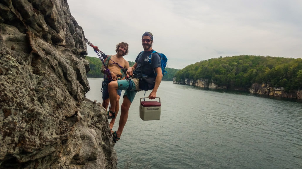
I put out the call on social media and recruited two passionate stewards of West Virginia’s waterways to become citizen scientists: Tomi Bergstrom, a Watershed Basin and Project WET Coordinator; and John Lichter, a raft guide-turned-entrepreneur. I received invaluable assistance from friends along the way who provided gear, adventure support, or just tagged along to help document the project.
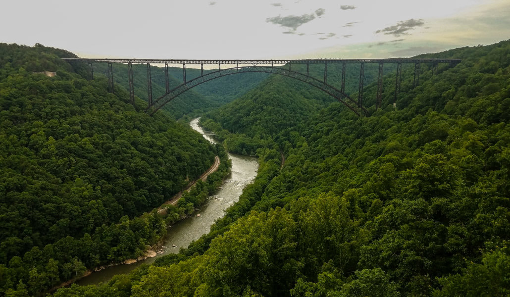
I also collected a handful of samples in central West Virginia on the fabled whitewater of the New, Gauley, and Meadow rivers in a region I frequent for some of the best rock climbing in the country.
Our army of citizen scientists hiked, paddled, biked, and climbed around the Mountain State. By the end of May, we had gathered 26 samples from 11 rivers, seven streams, and two lakes. Thanks to our collective efforts, that empty spot on the sample map now has the highest concentration of samples of any state in Appalachia.
I was shocked when I saw the results in September.
Of my 14 samples, just five samples from as many rivers contained a total of eight microplastics: seven blue fibers and one piece of transparent film. Of John Lichter’s 10 samples, only two samples from as many rivers contained two microplastics: one blue filament and one transparent filament. Tomi Bergstrom collected two samples; one of which contained one piece of microplastic: a red filament.
To date, around 48 percent of freshwater samples analyzed from the global project have contained microplastics. Just eight of the 26 West Virginia Samples, or 31 percent, tested positive—notably lower than the global average. While regular, comprehensive sampling is needed before conclusions can be drawn, these preliminary findings provide the possibility that West Virginia’s remote waterways and main arteries are comparatively low in microplastic pollution.
When the findings of the Global Microplastics Initiative are published in 2018, I plan to be on the front lines in support of clean water.