Steve Weileman & The Ikkatsu Project Collecting Samples Across Alaska
Steve Weileman, professional wilderness guide, and award-wining filmmaker and environmental advocate has teamed up with ASC on the Ikkatsu Project’s latest endeavor.Steve’s photography has been featured in The Forgotten Shore: A Photographic Journey Through Alaska’s Snug Harbor and his film debut, Ikkatsu: The Roadless, won multiple awards, including best environmental film at the Waterwalker Film Festival in 2013.
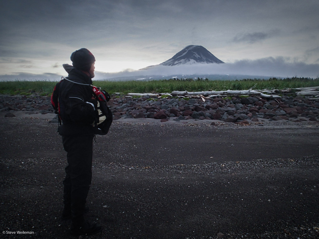
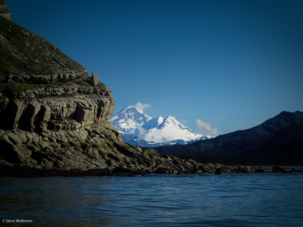
Augustine Island and the most active volcano in Alaska. Photo by Steve Weileman.
From Steve:
THE INTRODUCTON – For the past two years my partner, Ken Campbell, and I have been helping track marine debris from the 2011 Japanese tsunami event. We call it
The Ikkatsu Project. Ikkatsu roughly translates as ‘in this together.’ We felt this was appropriate, as this event truly brings both cultures on either side of the Pacific together. Last year, we traveled down the Washington Coast by kayak, which allowed us access to beaches unavailable by any other means. In addition to looking for specific tsunami debris, we conducted marine surveys for NOAA (you can see our report
here). We also released an award-winning documentary entitled
Ikkatsu: The Roadless Coast, which you can watch in its entirety
here.
For this year, we chose an even more arduous task: take our kayaks and research methods to a remote island in Alaska. Augustine Island, located at the entrance to Cook Island, hosts the most active volcano in Alaska. With the exception of a few geologist from the Alaska Volcano Observatory, it receives almost no visitors. In order to maximize our contribution to science, I contacted the staff at Adventurers and Scientists for Conservation and asked if they had any projects that would benefit from our location and ability. They put me in touch with Abby Barrow, Coastal Monitoring and Outreach Coordinator for the Marine Environmental Research Institute. One Skype conversation and a few emails later, we were set to collect water samples for Abby as part of her micro-plastic program.
A glimpse into the “Secrets of Augustine”. Video by Steve Weileman.
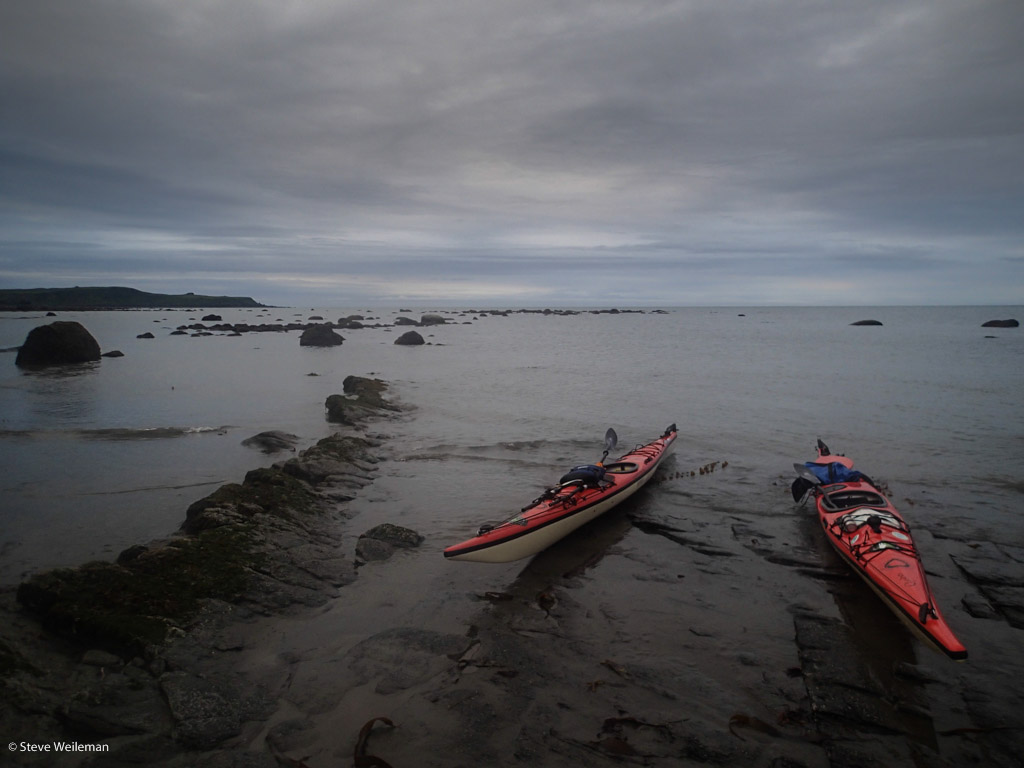
THE INSIDE PASSAGE – Once again, we were using our kayaks to get to those remote areas for this year’s study. All told, we’d have to transport our boats some 2100 miles to get to our destination. A large part of that distance would be traveled up the Inside Passage onboard the M/V Kennicott – one of the ferries operated by the Alaska Marine Highway System. From Bellingham, Washington to Homer, Alaska would take six days of travel with stops in ports such as Ketchikan, Juneau, Whittier and Kodiak. We choose to take the ferry for multiple reasons, but the primary one was to show the audience the distance and remoteness of our ultimate destination; boarding a plane in Seattle only to disembark in Anchorage a few hours later certainly doesn’t convey the remoteness of Alaska.
During the transit up the passage, Alaska was experiencing record-breaking high temperatures and on many of our shore excursions, we melted in the unusual weather. Had I only known what was in store for us, I would have done much less complaining and a bit more sun worshipping.
Foreboding weather. Photo by Steve Weileman.
HOMER TO AUGUSTINE ISLAND – We arrived late at the ferry terminal located at the end of Homer Spit, but that was hardly the end of the day for us. First, I had to locate a trunk that was graciously loaned to us. Then it was off to pick up the sample bottles I had shipped up before our departure and stop at the local grocery to pick up some fresh food. Finally, somewhere around 2AM, we were able to grab a couple of hours sleep in the public marina parking lot.Then we were up at the crack of dawn to repack our kayaks and board our marine shuttle for the tooth-jarring, three-hour ride out to the island. We had chosen the title Secrets of Augustine for this year’s project, and it turned out to be appropriate; it wasn’t until we were within a half-mile that the fog started to lift, and we caught our first glimpse of the island.
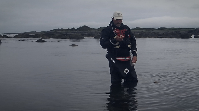
Collecting water samples for MERI. Photo by Ken Campbell.
THE SCIENCE – We had three individual programs of science that we hoped to perform in the field, but we were only able to perform two of them. The project to collect the stomach contents of bird carcasses for Oikonos didn’t come to fruition, as we never found any carcasses to examine. I think the resident populations of fox and bear regularly patrolled the beaches on cleanup duty. We were able to conduct quite a few of the Standing Stock Surveys for NOAA. This entailed dividing 100 meters of beach into 20 five-meter transects. We randomly picked four of those transects and counted every piece of debris larger than a bottle cap. We also took one-liter water samples, recording the latitude/longitude, water temperature, wind speed and direction. These will be examined for
micro-plastics and will become part of a world-wide database.
Paddling in remote Alaska. Photo by Steve Weileman.
OUR CHALLENGES – This trip presented quite a few challenges – some foreseen, some not. Looking at the marine charts and topo maps, it was easy to see that the entrance to the lagoon on the west side of the main island was protected by boulders. What we didn’t anticipate was the length of the portages we’d have to make due to the accompanying shallows. At times, we had to carry boats and 400 pounds of gear close to a half-mile… exhausting work. Typically, you plan your paddles around the tides, but here it quickly became evident that we had to plan around the weather more than the tides. Speaking of wind, I’ve never experienced the rapid onset of heavy wind as I did around Augustine Island. It was only our second day on the island when we were assaulted by the wind. Trying to make our way through the rock garden, it went from dead calm to 40+ knots of wind in a span of 15 minutes. Get caught in these conditions while offshore, or on a lee shore with no landings available, and the outcome would be truly grim. Most afternoons, with only one exception that I can think of, the winds were in this range. That’s why we planned our paddles for early mornings regardless of the tide level; it was the only way to get any mileage.
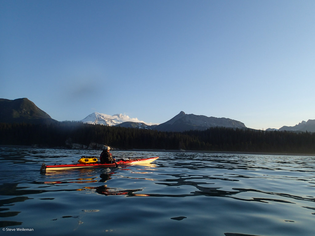
Compounding this was our isolation. The entire time we were on the island – ten days in total – we never saw another craft. We had a VHF radio and even a EPRIB, but there wasn’t anyone in the vicinity to respond. There were also large sections – sometimes miles – without any landing at all. High, rocky cliffs came straight down to the water’s edge. We could see debris scattered on the ledges or rock piles, but there wasn’t a safe method to survey them. Fortunately, once we made the open water crossing from Augustine Island to the mainland – a seven-mile crossing that on windy days I’d sit on the hill watching, the massive waves and whitecaps roaring northward – every mile traveled north took us into more moderate weather. By the time we reached our ‘take-out,’ Snug Harbor Cannery on Chisik Island, we were back in sunny, calm weather.
Welcoming the return of good weather. Photo by Steve Weileman.
Overall, it was a mentally and physically tough experience, but I can’t begin to describe the satisfaction I felt knowing that my efforts were making a difference in helping solve some of our planet’s issues. By taking the time to collect the water samples and the survey data,
the sense of reward I felt was tenfold what I would have felt if I had been there just for the experience. Having participated with a program facilitated by Adventurers and Scientists for Conservation, I can’t imagine
not using my particular skills to help; anything else would seem selfish and hollow.
If you want to contribute to science and conservation during you next adventure, find a project and get involved! Keep track of our stories on Facebook, follow us on Twitter (@AdventurScience), and support our mission!