Landmark Crew Member
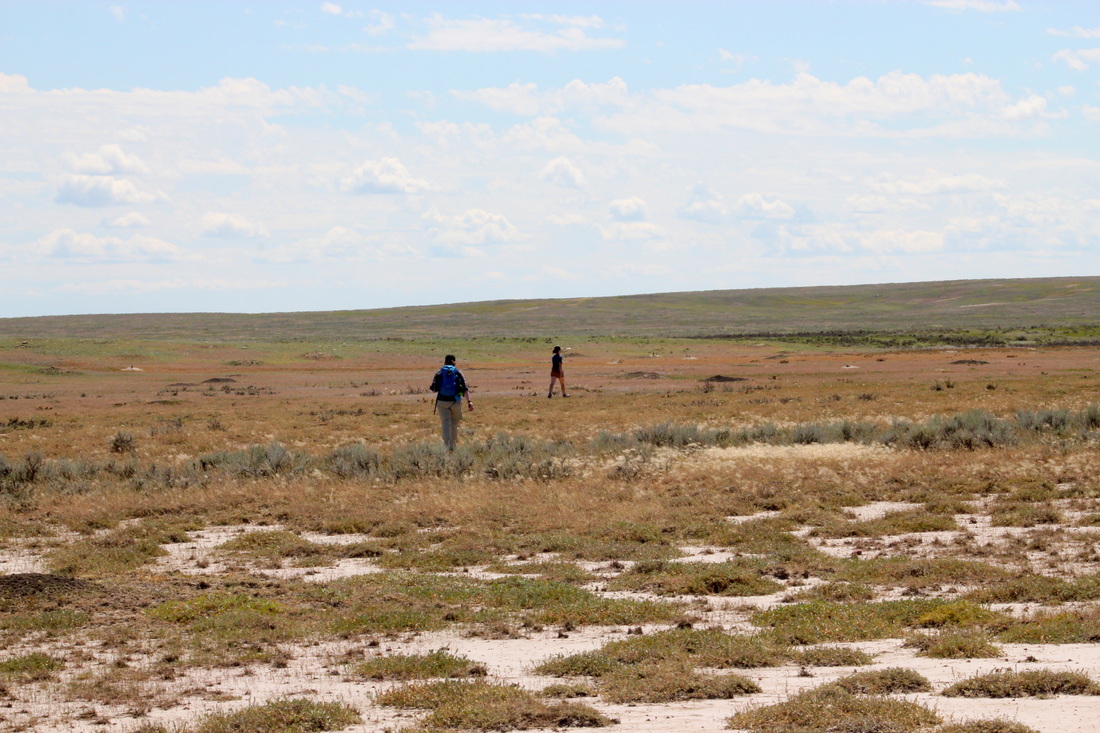
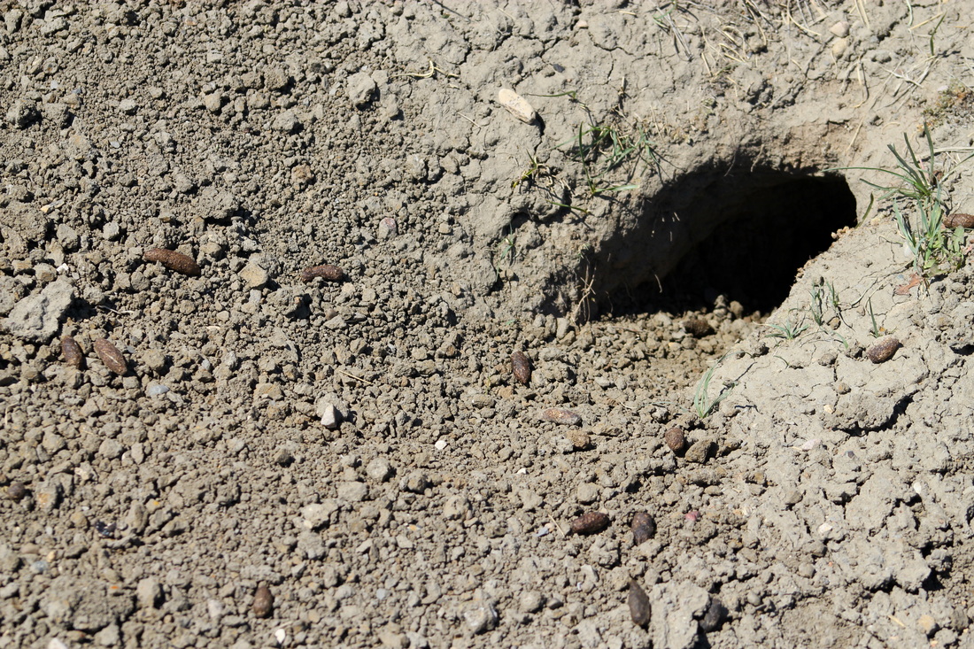
The sun has cooked the hardpan into hot white concrete underfoot and shimmers in the morning heat. As we walk, volunteers’ boots succumb to the dryness and the soles peel off and start flapping. But we’re almost there; ahead of us rises a broad grassy mound, incongruously green in this arid landscape. It’s big, maybe half a mile wide, and studded with industriously constructed little dirt mounds. On most of the mounds we can see one or two prairie dogs, pot-bellied and sand-colored, sitting upright, watching our approach. We cross some invisible line and the nearest prairie dogs start barking an alarm call, which quickly spreads across most of the town. This yipping follows us until we find our stopping point and settle down to work.
In recent weeks, the Adventure Scientists Landmark crew has been scoping and mapping American Prairie Reserve’s prairie dog towns. Each town receives the same three-step protocol. On a good day we try to bang out three or four of these. The steps are as follows:
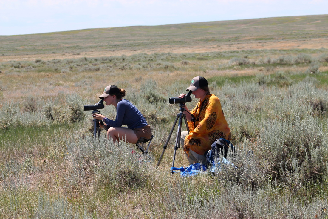
1.) Two to four observers arrange themselves on a vantage point (ideally 300 yards away) overlooking a town. Once there, we sit on folding stools and scan quietly for one hour using binoculars and birding scopes. We’re looking for any of 29 “species of interest” chosen to indicate the health and diversity of a prairie ecosystem. Any SOI that turns up is logged digitally into our database, along with a timestamp, GPS coordinate, and photograph, provided they stay still long enough.
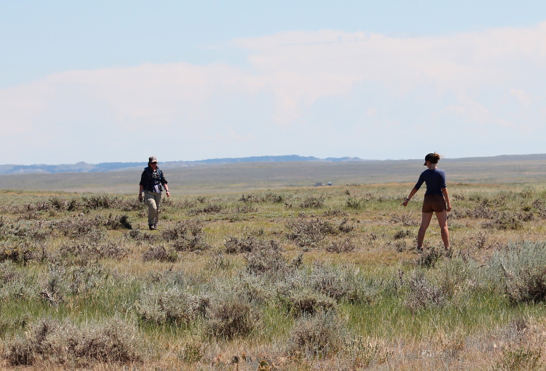
2.) The borders of the town must then be defined and logged onto a GPS. This requires two people. One starts at an outermost active hole with a GPS tracker in their pocket, and they walk slowly from outer hole to outer hole along the perimeter. Not every prairie dog hole is conveniently obvious, however, so a second worker walks ahead and to the outside of the first, amongst the dilapidated, abandoned holes around the town’s edge. When this second walker finds an active hole, he/she alerts the GPS holder to divert their course to include it. The course of the GPS in the inner worker’s pocket eventually traces a bizarre, amoeba-ish loop. This shape goes into a database and can be compared with its predecessors from previous years.
Protocols hit the rocks a bit when applied to the actual prairie. Starting at about 9 am, the heat rising from the ground in the summer reduces everything beyond about 300 yards to a wavering blur. Is that a burrowing owl or just another prairie dog? Or a fencepost? Furthermore, prairie dogs seem to prefer to build on high ground, such that convenient spots from which to scope are rare. Oftentimes we’re only able to see one slope of their hill; any attempt to gain higher ground brings us too close to the borders, which gets us lustily scolded by a hundred little voices and kind of throws off the wildlife-friendly vibe.