Have you ever gone far into the wilderness and wondered how scientists get data from such remote places? Sometimes scientists go with instruments stowed in expedition packs, but others depend on Adventure Scientists. Volunteer Lindsay Hunt shares her adventures during the past year on the Green River with her partner Sean Tropsa and how they give back as citizen scientists volunteering on the Wild and Scenic Rivers Project. The project aims to fill critical data gaps for water quality on designated Wild and Scenic Rivers. Volunteers are trained to collect data in the field so that scientists and land managers have a better understanding of the health of our rivers and whether or not an intervention is necessary. Read further to find out what kind of adventures you can be a part of.
By Lindsay Hunt
As someone who spent most of my life on the eastern side of the Mississippi, it never occurred to me that we were running out of water. With climate change in our face now more than ever it’s harder for me to silence that reality. My partner, Sean, and I both live by the phrase “be the change you wish to see in the world” and I can’t find a better way to do that than to volunteer while filling my weekends with adventures.
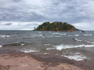
Looking out from a popular spot on the south shores of Lake Superior
During college, my weekends consisted of adventures along the southern shore of Lake Superior; camping, hiking, scuba diving courses, cliff jumping, and beach picnicking. This is where the water really shaped me. I would leave stressful days at the road that parallelled the beach and then I could restore my inner peace once I immersed myself in the frigid water of Gitche Gumee. It’s as if the current would dance into my body and carry the stress out into the deep expanses, leaving me free to move on through life.
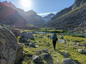
Backpacking near the headwaters of Green River
In July of 2020, Sean and I went on a backpacking trip in Wyoming’s Wind River Range and hiked by the headwaters of Green River. At that time there was no shortage of water because everything was melting out. It was squishing up from the grasses, cascading over the rocky trails, and most definitely flowing in through my shoes. It took us two days of backpacking to reach the headwaters. The tiny lakes below the glaciers were a beautiful turquoise blue that begged me to drink from the unfiltered freezing water. We continued up, following cairns over a col– essentially the lowest section of a ridge between two mountains. Looking up at the low point had me buckling at the knees and gasping for air… we were, after all, heading up to just above 12,000ft of elevation.
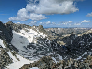
View from the top of Knapsack Col looking down at Stroud Glacier in the Wind River Range, WY
Once over the col, we concluded our time with the Green, however, that was just the beginning of my thoughts about water and its travels. So many beautiful alpine lakes painted our two days of hiking back to our car. We saw so many folks camping near the clear alpine water. Ideally, you should camp 200 feet away from water sources, but in some instances, it’s almost impossible. This got me thinking about water quality and how it is collected in these remote places. It wasn’t until a citizen science project for a Saguaro Cactus Survey popped up on my social media feed that I got an answer.
Soon after, my partner and I signed up for the Wild and Scenic River Project so that we could continue adventuring but adventure for a cause.
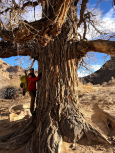
Sean hugs a large cottonwood tree, who we kindly refer to as our Butler Wash friend
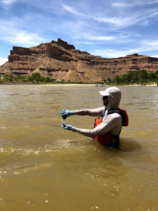
In February 2021 I grew closer to the Green. After I drank from its headwaters– when it was a tiny trickle– I felt a pull to check out how the Green held up in other locations. Our first Green River sampling adventure started out on a cool February morning. We rolled out of camp on our bikes and began the ride to a popular boat ramp where we walked to a huge cottonwood tree that would probably need six adult tree huggers to give it a proper hug. We blew up our boats, put on our drysuits, and we were off! Shortly after launching, we ran our first rapid which gave me a splash in the face that brought me back to the Winds. We finished by collecting water samples and real-time water quality data with handheld probes.
April’s visit was a little more intimate. We stopped at Green River on our way back from a Yurt trip in the La Sals. We were returning from skiing in the heart of the desert, where the landscape juts up into the sky creating a stark contrast of snowy temples among the red sandstone. Sean proposed to me in a glade that we had skied several times the season before. Like many generations before us, our hearts belong to the land. This desert, these mountains, and the rivers before us bring so much meaning into our lives and I feel a certain duty to make sure that I am doing what I can so that future generations can continue to thrive in and off of these places.

Petroglyphs alongside Green River
And so that they can respect the Indigenous populations that cultivated and worshiped these places thousands of years before white settlers arrived. After paddling and collecting samples we set our camp chairs along the river bank and let the sun kiss our skin. It felt nice to relax along the river and listen to the water move across the rocks and smell the budding desert.
In July, we stopped in the heart of Green River to get a giant breakfast burrito to fuel us through the day. At the take-out–where we locked up our bikes–the river banks were like a small village of bustling people excited to get into the water or start their shuttle back to the put-in for a famous desert river trip. We continued to the end of the road, parked our car, and began our trip down river. We saw folks out enjoying the water in the stifling heat, just as we were. The mood of the river was so much more playful with all the people that were recreating. We saw curious bighorn sheep peeking over boulders at us. Even the fish were adding to the lightheartedness of the day: While we sampled at our last site I stood in the water to cool off and found them nibbling on my toes. We dunked ourselves in the Green before we began our bike ride back to the car.
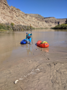
Sean collecting a grab sample from Swasey’s Beach
Sean and I managed to sample the Green a few more times since that time in July, my favorite trip. My second favorite was when nothing went as planned.
It was a few days after a high precipitation event went through the area. The river was like a thick chocolatey soup, not its usual green. It’s interesting to me the different ways that a location can change–not just through seasons but from weather systems or over-use. It’s difficult to see these subtle changes, but by consistently going back to the same location I am able to build an intimate relationship with this place. Repeated trips also allow me and my partner to get creative with how we approach our adventures on the Green. On this particular trip, I was experiencing boat issues.
Battling mud with amazing suction made for an adventurous exit
We were only able to cross to sample from a small river that feeds into the Green. Then, we had to call it off and ferry back to the car as my boat began to show signs that it would need a significant repair. Instead of fixing the problem in the field, we decided to explore the canyon. After a couple hours exploring, visiting side canyons that were still damp from the storms, we made it to the last sample point. The campground was quiet and the beach only had one other person.
The season was coming to an end and with it the leaves were starting to turn their autumn gold.
By sharing a few of the stories that I’ve had on the Green and my other precious place on Lake Superior, I hope I can get you thinking about the water that you can recreate on, that you drink, where it comes from, and how you can find a way to protect it. For now, Sean and I will continue to stop by the Green to collect samples when we go down to visit the desert. However, our main focus will be focusing on running more alpine Wild and Scenic Rivers to prepare us for our August 2022 sampling adventures in Alaska’s Gates of the Arctic.
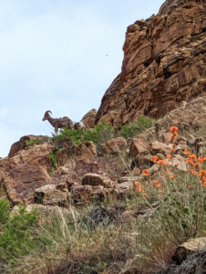
Some curious bighorn sheep
Do you know about the Indigenous land that you recreate on? Check out this interactive map to learn more about the rich histories that are finding their voices again through documentation. When visiting these areas please remember that these places are to be respected. Honor these places by sharing their stories, educating yourself, or by donating to a local tribe.
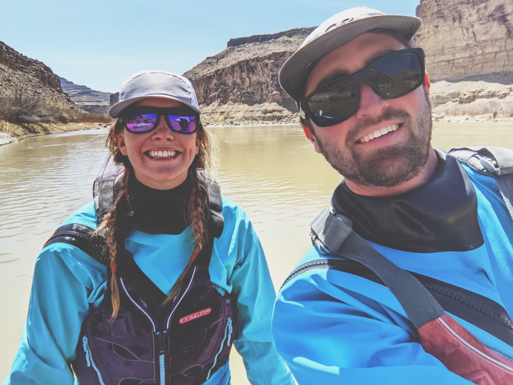
Lindsay and Sean