
I’m in Toamasina now and have spent the last week getting here from Antananarivo, also known as Tana. I had some good fortune and met a French cyclist my first day on the road and we will ride together for much of the trip. So far, the trip has been a bit like Jeckel and Hyde. The main highways are very good but the secondary roads are terrible.
The climb out of the highlands around Tana was pretty brutal but the descent was magnificent. We stopped in the highlands to visit a few NGOs that are trying to promote eco-tourism as a way to save the remaining forest. The forest is fast disappearing as the population of Madagascar continues to expand.
After a few days in the highlands, we took the main road to Brickaville and took a detour off the main highway towards the Pangalanes. This area is very swampy and accessible by boat and the occasional train. There is a path that runs alongside the railroad that is navigable by bike. Unfortunately, it became a path of loose sand and we ended up pushing the bikes for ten km to the next village. There, we learned that the sand path would continue for the next 60 km. The only other ways out were by boat or the occasional train. Fortunately for us, the occasional train passed by and we are now in Toamasina, planning to head north soon.
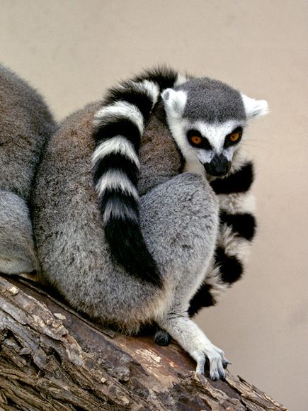
I had hoped that there might have been some presence of lemurs in the Pangalanes but the area has been too heavily populated. So far, the only lemurs that I have seen were in the reserves. En route and in the villages, there are plenty of lizards and frogs but human inhabitation has pushed the lemurs further and further away.
Post 2
I’m now in Diego Suarez, the most northern city in Madagascar. It took some time to get here along the coast as the national route, if you can call it that, was more like a trail than a road in some parts. The route started off well from Tamatave, where it was paved for the first 150 km. This part of Madagascar has a very tropical climate which is good if you need to grow some bananas but bad if you want to ride a bicycle during the day. Along the east coast, cloves grow very well and the air was filled with the scent of cloves drying in the sun.
However, after S-Ivongo, the road turned to dirt and then to sand. I had to push the bike through 15 km of deep sand in the blazing sun that day. Certainly not what I would consider fun. From that point, the road, if you could call it that, alternated between sections of sand and steep, rocky roads with ruts of lumpy dried mud. This road has been called the worst road in Madagascar and I can certainly agree.
After about two hundred kilometers of pushing through sand, countless pirogue crossings, and difficult maneuvers to find smooth single tracks through dried mud ruts, the road ended at the town of Maroentsetra. There are two trails from there. One goes over the mountains and the other along the coast. Both go through the National Park, necessitating the use of guides and porters. Instead, we waited for a boat to take us to Cape Masoala, where there is a dirt road that continues north towards Antalaha.
The dirt road along the east coast is relatively new and so far, few tourists have come this way. Through most of Madagascar, children cry out “Bonjour, vazaha!” when they spot a passing tourist. Along the coast, some children run away in fear, as their parents had told them “Be good, or the vazaha will come and eat you!” Close to the cape, the road is still forested but the further north one goes, the more populated the road becomes.
Even though the road was not the forest I had been expecting, it was still strikingly beautiful, with impossibly diverse shades of green and the seemingly infinite, deserted beach that stretches along the coast. After a few more days of sandy roads and pirogue crossings, we hit pavement about 10 km out of Antalaha.
After so long without pavement, riding seemed effortless. I took a detour to visit Maroejejy National Park while the French cyclist continued north. After an amazing visit of seeing lemurs, chameleons and colourful birds, I started to ride north. About 20 km into the ride, the side wall on my rear tire ruptured, tearing a hole in the innertube. Unfortunately, I didn’t know this was the problem at the time, and tore a hole in my other inner tube.
Sometimes, you just have to call it a day. The first taxi brousse to come by was headed to Vohemar, my intended destination. I loaded the bike and squeezed between two women in the taxi-brousse. Malagasy are in incredibly good shape from all the physical labour and I felt like I was being pushed between two sacks of tires for the rest of the five hour trip to Vohemar. In Vohemar, with the help of someone at the hotel, I found a mechanic who stitched together the blown sidewall. As luck would have it, there was a boat leaving the next day for Diego Suarez, my next intended destination.
I am now in Diego Suarez, with a new tire in case the stitching does not hold. This part of Madagascar is much hotter and drier than the east coast. It will be a different challenge to try to stay cool while riding. I’ll be heading to Cape Ambre tomorrow, the most northern point in Madagascar. From there, it’s back to the capital city.