
Now that I have nearly completed my journey across the desert, I am in a position to report on how I have observed the impact of fire, particularly the major bushfires that began in September 2011. Fire has shaped the Australian landscape for thousands of years and is part of the desert boom/bust cycle.
In conjunction with Sydney University’s Institute of Wildlife Research and Adventurers and Scientists for Conservation, I am keeping a detailed record of the actual ‘on ground’ impact of the fires. This is known as ground truthing and will give researchers more detailed information that can be used alongside satellite imagery. I have also been collecting scats from dingos, cats, foxes and larger raptors. These will be analyzed to see what these animals have been eating in recent times. As you would expect, the long haired rat figures prominently in the diet of these predators. The scat count to date is 124 samples.
Up until five days ago, I would estimate from my journal, that approximately 85% of my journey to date has been through country that has been affected, in some degree, by fire in the last 12 months. For my own ID purposes, I have made four levels to help categorize the different impact of the fires.
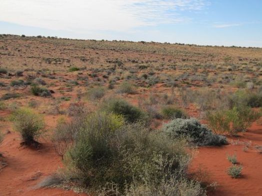
1 – country completely burnt with little or no established shrubs/trees remaining. All spinifex completely missing from landscape.
2 – country completely burnt in a ‘slow fire’ with some established mid-level shrubs remaining relatively unburnt. All spinifex missing from landscape.
3 – country completely burnt in a ‘slow fire’ with some established mid-level shrubs remaining relatively unburnt and some small isolated patches of spinifex remaining.
4 – gidgee forest fires that have burnt to the top canopy and the trees are now re-shooting.
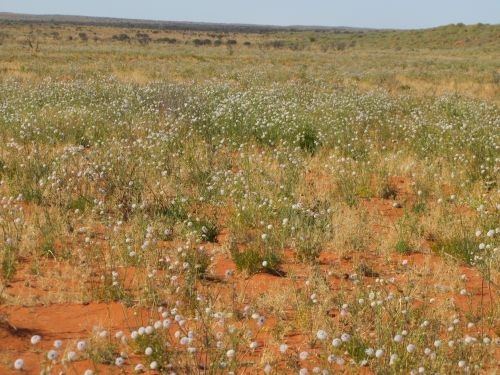
In my 16 years of walking in the Simpson, I have never seen it like this – no spinifex. I actually saw some today and stopped to take a photo of it, it was so unusual to see it. Of course, in some parts of the desert, particularly the further south you travel into South Australia where the salt lakes begin, the spinifex becomes naturally thinner on the ground. But to walk from Andado to Eyre Creek and hardly see any at all, is (for me) very rare.
Andrew Harper has been traveling the Simpson Desert with his trusty team of camels for 16 years either on commercial trips or scientific trips. He decided to trek the desert this time to explore the desert himself. Read more of his adventures at https://reconnxpedition2012.wordpress.com/latest-news/